


Eleven and a half kilometres. Two hours fifty-four minutes. A Saturday in December when the rest of Bournemouth was presumably in a shopping centre.
Hengistbury Head is one of the most historically significant pieces of ground on the south coast — occupied since the Palaeolithic, an Iron Age port of serious importance, the first thing approaching an urban settlement in England. In July it is also a place where you queue for an ice cream and watch children fall off paddleboards in Christchurch Harbour. In December it is something else entirely.
I started from the Southbourne seafront at 09:40 and was back by 12:34. The GPS track is on my AllTrails profile.
Southbourne beach — the approach
The route drops from the overcliff at Southbourne onto the beach and heads east. In December this stretch of sand belongs almost entirely to dog walkers and the occasional runner. The contrast with August, when you'd be picking your way around windbreaks for half a kilometre, is significant.
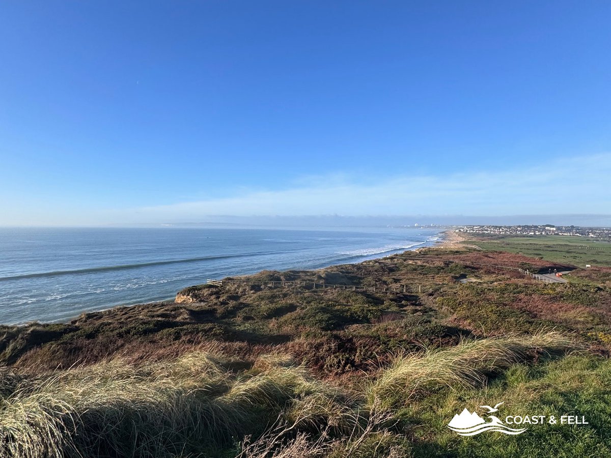
The beach itself is wide and firm near the waterline — good walking. The sea was running a decent swell when I was there, proper December energy, and the sound of it was the constant backdrop for the first section of the route. The cliffs to the left are soft Eocene sand and clay, crumbling and orange-brown. There have been landslips along this stretch and the base of the cliff is not where you want to be in wet weather or after heavy rain.
Walking east with the sea to your right, the bulk of Hengistbury Head grows steadily in front of you. From Southbourne it looks like a proper headland — a dark plateau ending abruptly in sand cliffs — and by the time you reach the foot of the path up, it's earned that status.
The Double Dykes
Before the headland, the Double Dykes. Two banks and two ditches cut across the neck of the headland roughly east to west, separating it from the mainland. Built around 700 BC by Iron Age inhabitants, the inner bank was three metres high, its ditch three and a half metres deep. Even worn down by two and a half thousand years of Dorset weather, they're still visibly substantial earthworks when you cross them.
The scale of what was here is worth sitting with for a moment. Hengistbury Head was, by around 100 BC, the premier port on the south coast for the import of continental goods — Italian wine, bronze, glass. Some historians argue it was the first genuinely urban settlement in England. None of that is immediately obvious when you're standing in a coastal car park in December, but it changes how you look at the landscape if you know it.
The path crosses the dykes and the character of the ground shifts — from beach fringe scrub to proper heathland. Heather, gorse, sandy soil. On a December morning with low cloud sitting on the head it has a bleak quality that I mean as a compliment.
Warren Hill — the top of the head
The route climbs to Warren Hill, the highest point on the headland at around 36 metres. It doesn't sound like much. It feels more than it is, partly because you've come from sea level, partly because the path opens up completely and gives you all the exposure of a proper summit even at this modest height.
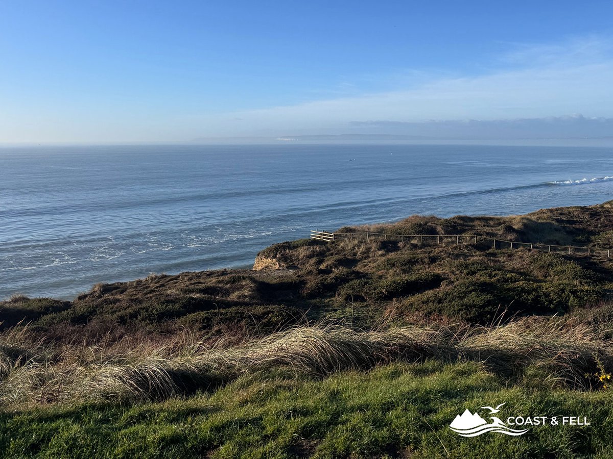
The triangulation point sits at the top of a broad plateau. On a clear day from here you get Old Harry Rocks to the east, the Isle of Wight beyond them, and the full sweep of Poole Bay behind you — Bournemouth's beach stretching west, the cliffs past Swanage visible in the distance. In December with cloud on the horizon the views are compressed but still good. The winter light on the sea has a quality that you don't get in summer, something lower and more horizontal, catching the water differently.
Old Harry Rocks marks the eastern tip of the Jurassic Coast, and the cliffs past Swanage are the start of the Purbeck coast I cover in my Corfe, Swanage and Worth Matravers circular. Keep tracking that coastline west and you eventually reach the arch on my Durdle Door circular walk, on the far side of Poole Bay.
The heathland on the top of the head is managed as a Site of Special Scientific Interest. More than 300 bird species have been recorded on and around Hengistbury Head, making it an important migratory point. I disturbed a small group of something from the gorse as I climbed and didn't identify them before they were gone — that's par for the course in December, when you're not carrying binoculars and moving at walking pace in the cold.
The eastern tip and Mudeford Spit
The path continues to the eastern end of the headland, where the land drops away and Christchurch Harbour opens up below you. Mudeford Spit runs south from the mainland opposite — a thin line of sand with beach huts on it that are among the most expensive real estate per square foot in the country, which is a fact that means nothing until you see how narrow the spit actually is and how exposed it must be in a winter storm.
The entrance to the harbour — the narrow channel between the spit and the headland — is known as the Run. In summer you can cross by ferry. In December the ferry doesn't operate and the channel is for looking at rather than crossing. On an incoming tide the Run moves with some force.
Standing at the eastern tip with the harbour to the north and open sea to the south is a good moment. The walk has been building toward it and it pays off. Worth stopping properly rather than hurrying past.
We crossed to Mudeford Spit and stopped at the café there — flat white and a panini, quiet enough in December that you have your pick of tables. It was a good mid-walk stop. The spit café is worth knowing about if you want a proper break rather than eating on the go.
The harbour return
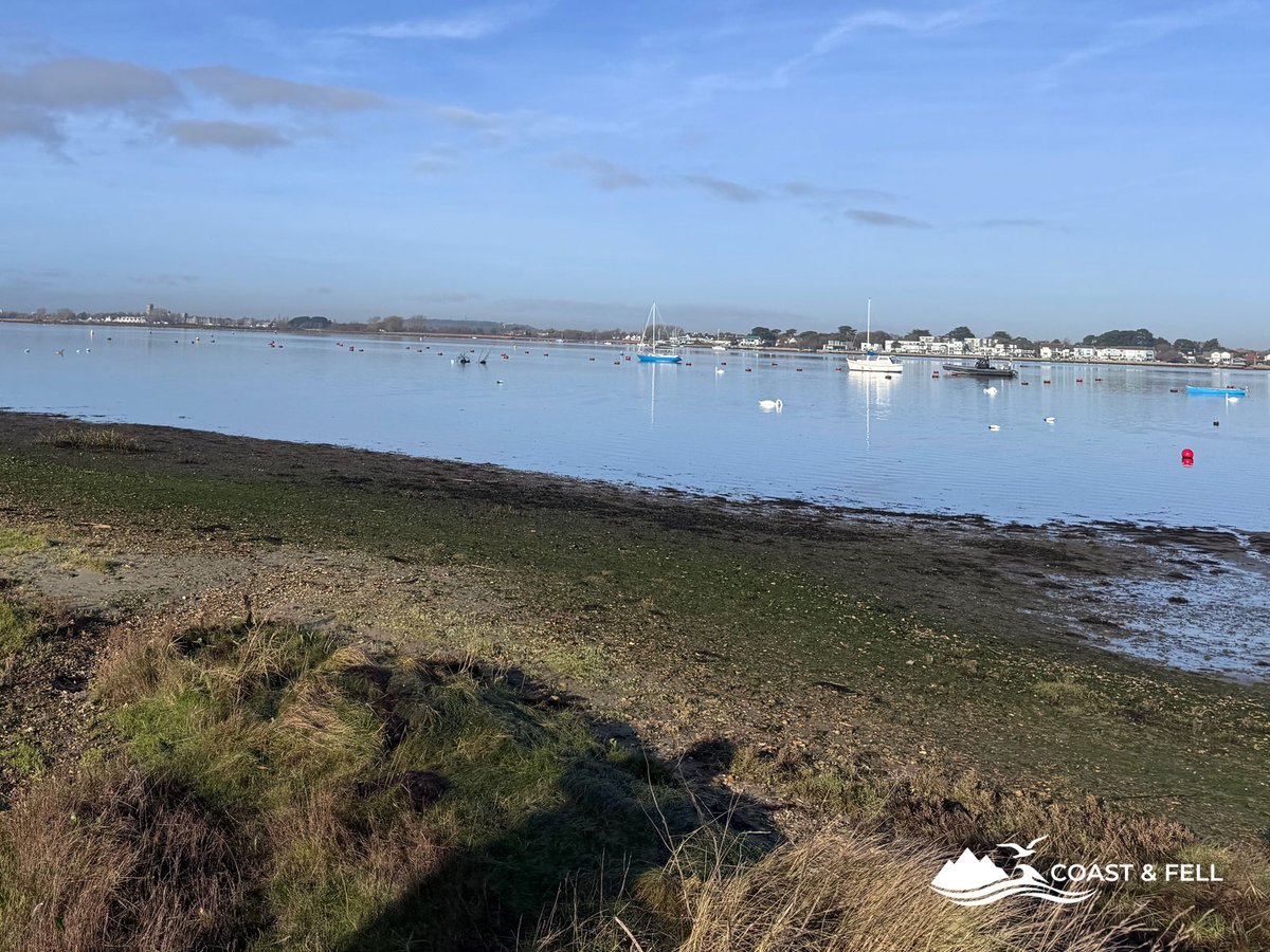
The return leg is a completely different walk from the outward journey. Where the ocean side is exposed, windswept and prehistoric in character, the harbour side is sheltered, flat and much quieter in a different way — reedy margins, still water, the occasional heron. Christchurch Harbour is a large but shallow tidal lagoon, and the path follows its edge on slightly lower ground than the heathland above.
The contrast within the same headland is one of the things that makes Hengistbury Head worth doing properly rather than just walking to the top and back. You're on two completely different pieces of coastline within a few hundred metres of each other.
The harbour-side path takes you back west through the nature reserve, past the visitor centre and the Hengistbury Head car park, and then continues until the route climbs back up to the Southbourne overcliff for the final section home. The climb back up is short but earns its elevation after a morning on your feet.
On this particular December day the tide hadn't fully retreated and the ground along the harbour edge was genuinely wet — soft underfoot in places, with standing water in a few spots. Waterproof boots are worth having for the return leg and they earn their keep in these conditions. Trail runners would have been unpleasant. The GTX held up without any drama.
What I wore on the day
Dry December morning, 7–8°C at the start with a noticeable wind off the water. The Salomon X Ultra 360 Leather Mid GTX was the right call — the headland paths are firm, well-maintained tarmac and gravel in places, but the return leg along the harbour edge was a different story. The tide wasn't quite out and the ground was genuinely wet underfoot. The GTX waterproofing held up without any fuss, which is exactly when you're glad you went waterproof rather than breathable trail shoes.
For socks, December cold calls for something with proper weight. The Darn Tough Hiker Full Cushion is the one I reach for when the temperature is down — more merino content, more warmth, and the full cushioning earns its keep over three hours on varied ground. The lightweight options are excellent but save them for warmer days.
Layering: the Rab Cirrus insulation as a mid layer under the Patagonia jacket for wind. The combination works well on December coastal walking — the Cirrus provides the warmth and the shell cuts the wind that comes off the water. On the headland itself, fully exposed, both earned their place.
Mountain Equipment Mountain Gloves — non-negotiable. On the beach approach you can get away without them if you're moving at pace, but on the exposed plateau at Warren Hill the wind is significant and bare hands become uncomfortable quickly. I kept them on for most of the walk.
I brought the Osprey Talon 33 — three hours doesn't really require it, but old habits. A smaller pack is perfectly adequate for a walk of this length. The hydration bladder made more sense than stopping for a water bottle, which is the main reason it came.
What you need to know
Parking: Street parking along the Southbourne overcliff roads (BH6 4BE area) or the pay-and-display car parks on Southbourne Coast Road. Alternatively, drive to the Hengistbury Head car park (BH6 4EN) and adjust the start of the route accordingly — this cuts a couple of kilometres from each end. Either works. The Southbourne start gives you the full beach approach which is worth having.
Distance and elevation: ~11.6km, ~290m of elevation gain. The maximum height is only 36m, but you're working up and down from sea level multiple times. It's an honest three-hour walk at a steady pace.
Season: This route works in any season, but the calculus changes. In summer it's popular, the ferry to the spit runs, and the visitor centre and café are open. In December it was empty enough that I had the headland to myself for most of an hour. Both are valid; December is underrated.
Café: There is a café on Mudeford Spit, accessible from the eastern tip of the headland. In December it was quiet and open — flat white and a panini were exactly right at that point in the walk. The Hengistbury Head visitor centre also has a café in the warmer months, but I wouldn't bank on it being open in winter.
Dogs: Allowed throughout, but on leads in certain sections of the nature reserve, especially where ground-nesting birds are active in spring and summer. Signs are clear.
The ferry: The Mudeford Sandbank ferry operates seasonally from the eastern tip — if you want to cross to the spit and extend the walk, this is your only option unless you go the long way round via Mudeford village. Check current operating dates before you plan around it.
GPX and AllTrails: The GPS track for this route is on my AllTrails profile — follow along for Jurassic Coast and Dorset routes as I add more over the coming months.