


I walk this part of Purbeck a lot. My usual loop runs from Corfe over to Swanage and round towards Lulworth, and Old Harry Rocks sits right on my doorstep. I have walked out to the stacks and up over Ballard Down a good few times over the years, in different seasons and different weather.
This time I took the chance to write it up properly. It is one of the most popular coastal walks in Dorset and we did not have a guide for it, so I went round with the camera and did it as a review. The loop takes in the chalk stacks themselves, the Pinnacles just along the cliffs, a short detour to the wartime observation post at Fort Henry, and the long pull up and over Ballard Down for one of the best views in the county, looking down over Swanage with the sea glittering below. It is only around ten kilometres, but it packs in more than walks twice the length.
The day I did it was a lesson in not trusting a forecast. It was raining and windy first thing, despite a dry forecast the night before. By the time I was walking it had cleared to proper sunshine and around 18C, with a stiff breeze on the ridge. More on what that did to my kit choices later.
Why this walk is worth doing
Most people who come to Old Harry Rocks walk out from Studland, photograph the stacks, and walk back the same way. That is a lovely short stroll and there is nothing wrong with it. But you would be turning around just as the walk gets interesting.
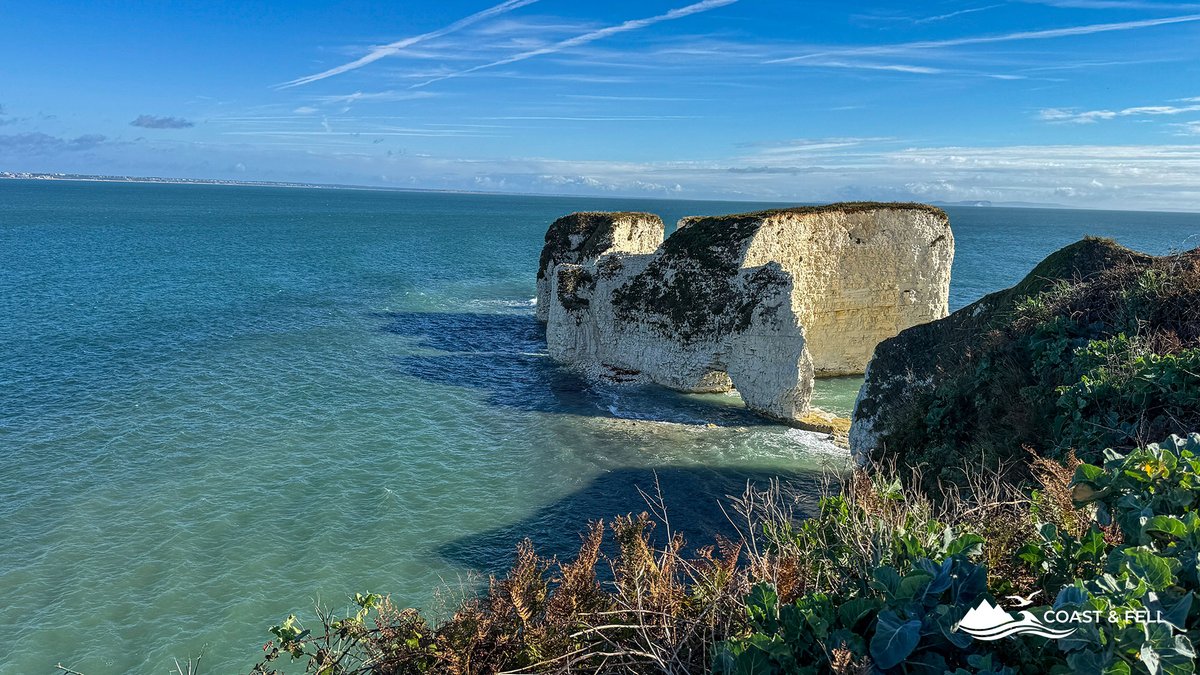
Done as the full loop, this route gives you three distinct bits of coast and country in one go: the white chalk headland and stacks at Handfast Point, the quieter cliff path with the Pinnacles, and the open, breezy ridge of Ballard Down with its huge views inland and out to sea. It is a proper circular with a real sense of having been somewhere, rather than an out-and-back.
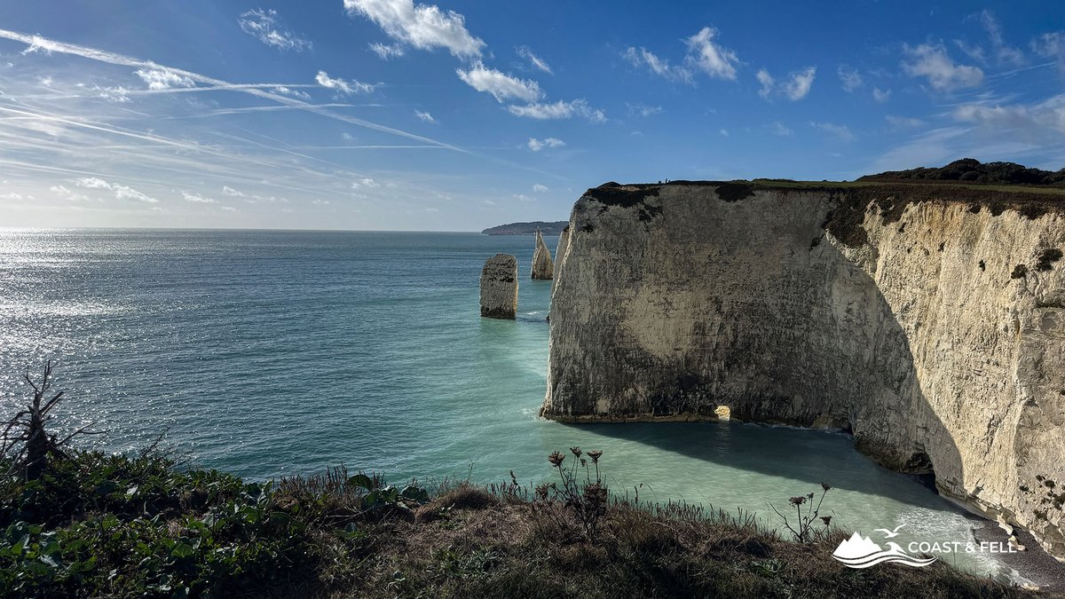
Here is the insider tip, and it is the one thing I would tell anyone doing this walk. Everyone points their camera at Old Harry Rocks. Turn around and look the other way along the cliffs towards the Pinnacles and it is every bit as beautiful. The whole area is stunning in every direction, and the people all facing one way are missing half of it.
The route at a glance
- Start / finish
- South Beach car park, Studland, BH19 3AU
- Distance
- ~10.3km circular
- Elevation gain
- ~215m
- Time
- Around 3 hours at a steady pace. Allow longer if you stop for photos or add the detours.
- Difficulty
- Moderate. Not technical and nothing scrambly, but the climb up Ballard Down is long and sustained, and the whole route is exposed with no shade or shelter.
- Terrain
- Coast path and grassy clifftop out to Old Harry, open downland on Ballard Down, and farm and field paths on the return
From South Beach the route heads out to Old Harry Rocks at Handfast Point (about 1.5km). From the stacks it follows the clifftops south past the Pinnacles, then climbs up onto Ballard Down and runs west along the ridge past the trig point, with the view opening up over Swanage. It then drops down to Ulwell, crosses the Studland road, and comes back over Dean Hill and through the field paths into Studland village and the car park. Fort Henry is not on the loop itself, but it sits only a few hundred metres the other way from the car park, so it works as a short out-and-back before you set off or when you get back.
Getting there and parking
By car: The walk starts from South Beach car park on Manor Road in Studland, postcode BH19 3AU, run by the National Trust. The approach road into Studland is narrow and winding, so take it slowly rather than rushing. I came down through Sandford on the way in. National Trust members and Blue Badge holders park free; everyone else pays at the machine. A rural postcode can misdirect a sat-nav here, so set it to "South Beach Car Park, Studland" by name, or use the car park location directly, and glance at the map before you leave.
A quick wander before you start: St Nicholas' church in Studland, near the car park, is a genuinely picturesque little Norman church, open during daylight hours. It is worth a five-minute look either at the start or the end of the walk.
Toilets: Go before you set off, because there are none out on the walk itself. They are not in the car park: head just down the road and you will find them right before the path up towards Old Harry. Knoll Beach car park, a little further up the road, also has toilets by the cafe.
Food and coffee: Everything is at the Studland end, there is nothing to buy out on the walk. Joe's Cafe at South Beach does pasties, cakes and hot drinks among the beach huts, Manor Farm Tearooms nearby does cream teas, and Knoll Beach Cafe (National Trust) a little further up has lunches and sea views. For a pub, the Bankes Arms is Studland's traditional village local with a beer garden looking over the bay.
By public transport: The Purbeck Breezer 50 bus (morebus) runs daily between Bournemouth and Swanage, crossing the harbour mouth on the Sandbanks chain ferry and stopping in Studland village a short walk from South Beach. Check the morebus timetable before travelling, and note the chain ferry pauses for refit periods, with the next starting in early November 2026.
Old Harry Rocks: the main event
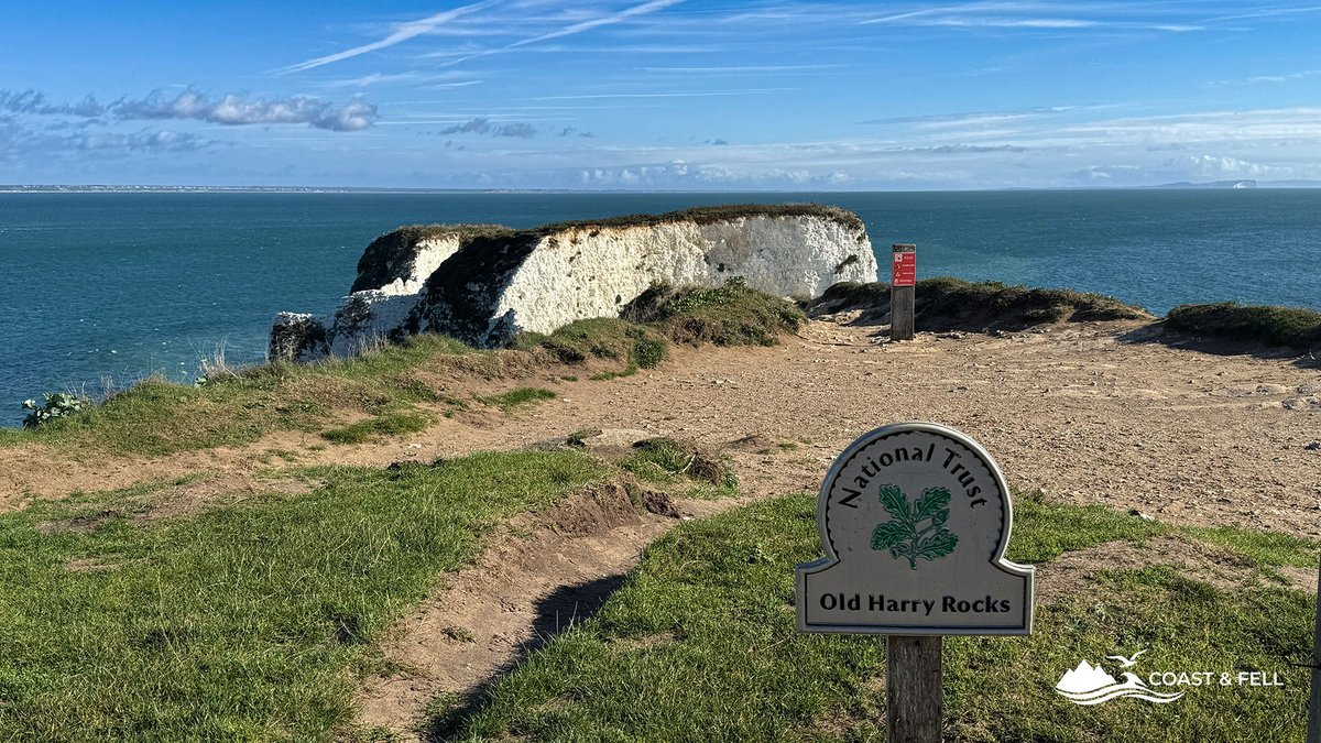
From the car park it is a gentle walk of around a kilometre and a half out to the stacks at Handfast Point. Old Harry Rocks are the gleaming white chalk stacks at the very end of the headland, left standing where the sea has slowly eaten everything around them away. On a clear day the chalk is almost blinding against the blue, and the water at their feet runs that pale turquoise that you expect from somewhere a lot further south than Dorset.
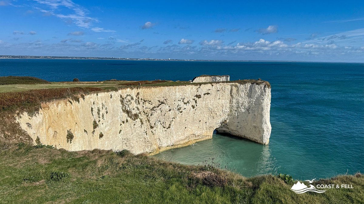
One thing worth looking for: the water right up against the base of the cliffs is milky and pale, while further out it runs clear turquoise. That cloudiness is chalk. These cliffs are actively eroding, and the fine calcium carbonate they shed hangs suspended in the water close in, scattering the light. The same chalk is part of what gives this stretch of sea its almost tropical colour, with the pale seabed and suspended particles brightening the blue wherever they collect.
A word on the edges. The cliffs here are chalk, and chalk is unstable and actively eroding. I saw people getting far too close to the edge for a photograph. Please do not. The view is exactly as good a few steps back, and no picture is worth standing on a crumbling chalk lip for.
Fort Henry: the wartime detour
Fort Henry is not on the loop, but it is so close to the start that skipping it would be a shame. The bunker sits on the clifftop a few hundred metres from South Beach car park, heading towards Middle Beach, so it is a ten minute out-and-back at the start or end of the walk.
It is a serious piece of concrete: 90 feet long with walls and roof three feet thick, built in 1943 by Canadian Royal Engineers and named after their home base at Fort Henry in Ontario. A narrow observation slit runs almost its full length, looking straight out over Studland Bay, and that slit is the whole point of the place. In April 1944, six weeks before D-Day, the bay below was used for Exercise Smash, the largest live-ammunition rehearsal of the entire war.
On 18 April 1944, Churchill, King George VI and General Eisenhower stood behind that slit and watched the practice landings. The rehearsals came at a cost: six amphibious Valentine tanks were swamped by the swell and six men drowned, and two of the tanks are still on the seabed out in the bay. The fort is Grade II listed, looked after by the National Trust, and free to walk into.
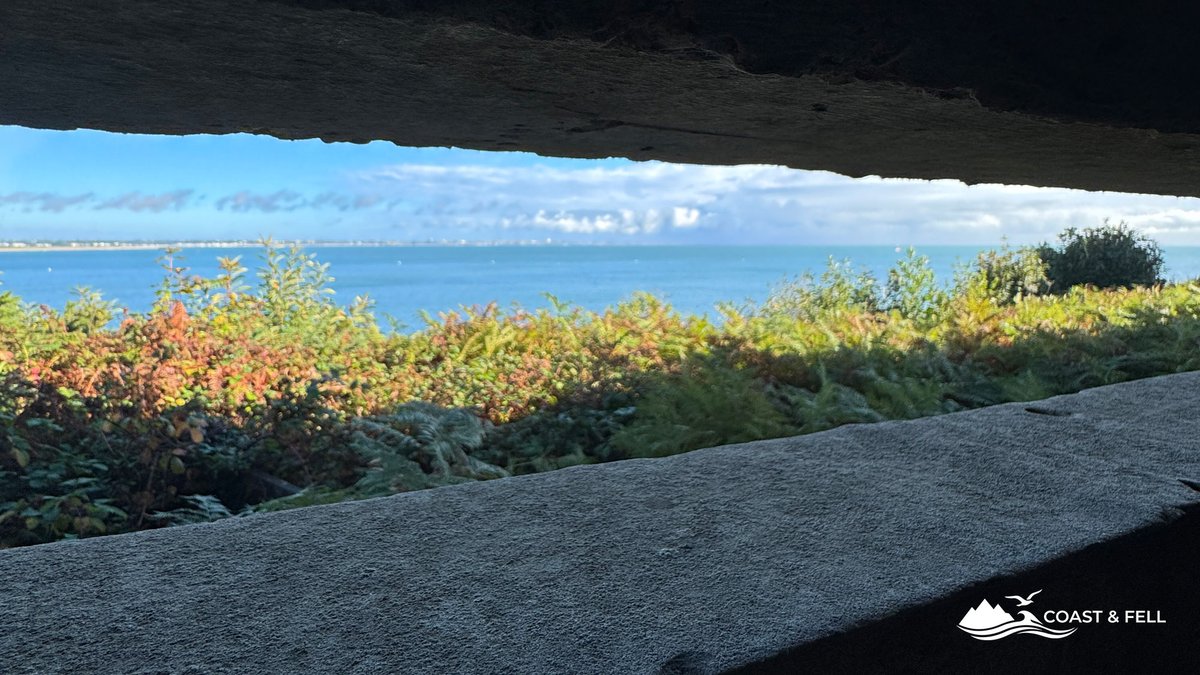
I had it to myself early on, no one else around. I stood looking out through the slit to the sea, and because I am tall I had to stoop right down to see through it at all. It is a strange thing, stooping to the same gap a King and a Prime Minister once looked through, out over a bay that is calm and empty now, knowing what was rehearsed there and what it cost.
Up and over Ballard Down
From the stacks the path carries on along the clifftops, past the Pinnacles, and then begins the climb up onto Ballard Down. This is the one bit of real effort on the walk. It is not steep or technical, but it just keeps going and going, a long, steady pull up onto the ridge. I have done far harder sections on this coast, but you do want a reasonable level of general walking fitness for this climb, and it is worth flagging for older walkers or anyone not used to sustained uphill.
You are exposed the whole way up, and it stays that way on top: open downland with nothing between you and the weather. There is no tree cover and no shade on the climb or anywhere along the ridge. On the day I walked it was mild at the car park, around 18C, but the wind picked up noticeably on the top and it felt cooler up there. Even on a warm day I would carry an extra layer for the ridge. In cold, wind or rain you are fully in it, and on a hot day there is no escaping the sun, so bring sun cover and plenty of water either way.
The reward for all that exposure is the views, and the ridge has them both ways: Swanage bay on one side, and Poole, Bournemouth and Sandbanks spread out across the other.
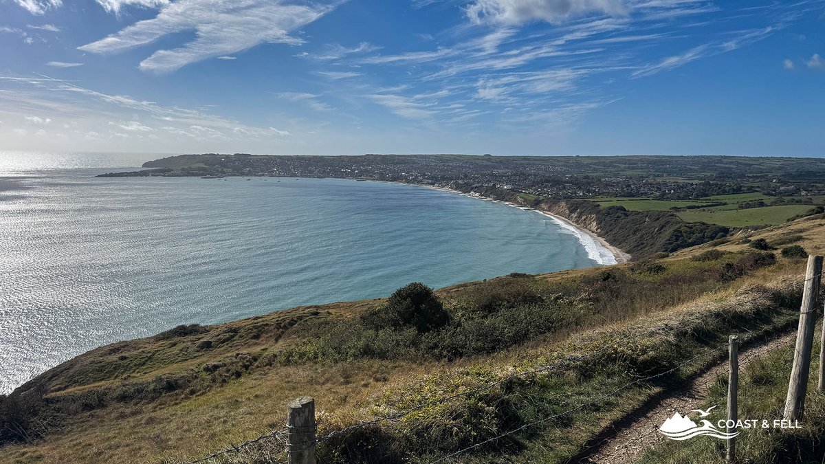
The trig point and the view over Swanage
The high point of the ridge is marked by a trig pillar, and this is where the walk earns itself. Looking down over Swanage from up here, I could pick out my usual walk, the Corfe to Swanage loop that carries on round towards Lulworth, laid out below me with the sun glittering off the sea. It is a lovely bit of perspective, seeing a route you know well from above. If that loop appeals, I have written it up as the Corfe, Swanage and Worth Matravers circular.
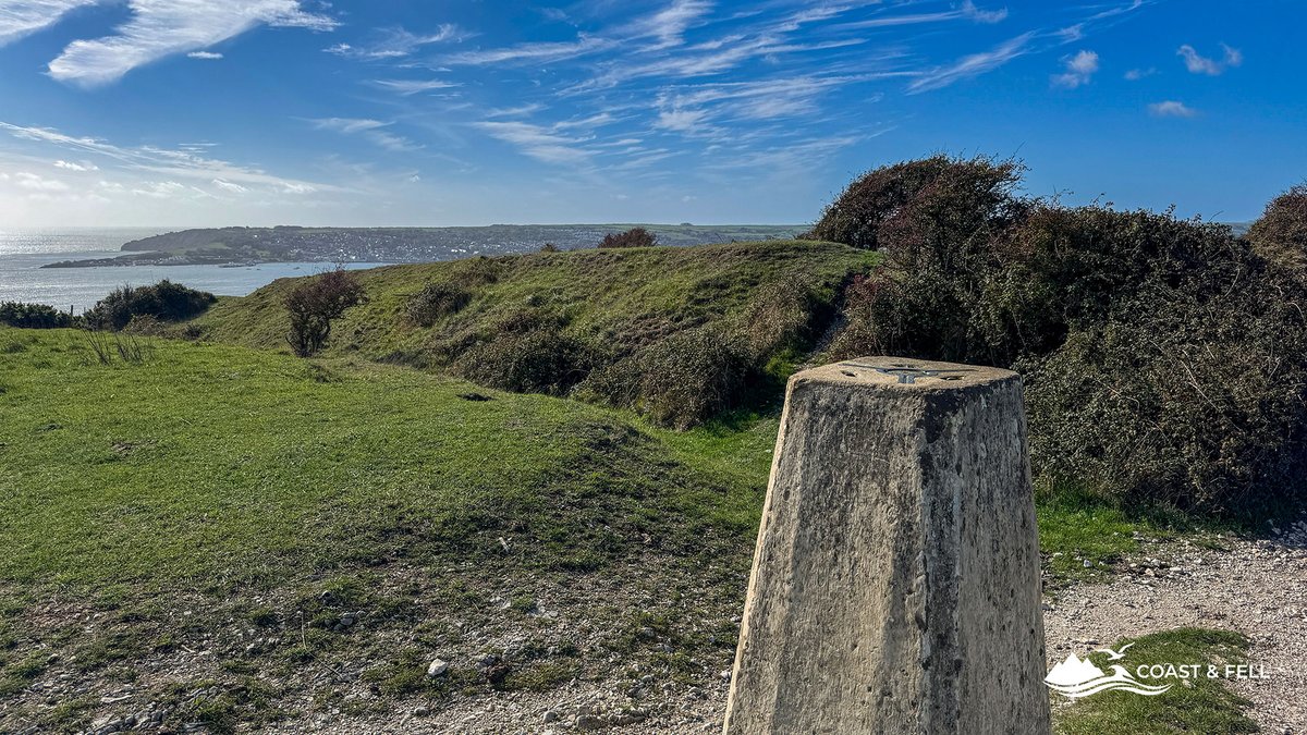
Carry on west along the ridge and, a little over two kilometres past the trig point, you reach the Swanage Water Act Obelisk, known locally as just the Obelisk. It is a hexagonal granite column standing on top of a prehistoric burial mound, and it commemorates the arrival of Swanage's new water supply in 1883.
It has had a life. It originally stood outside St Mary Woolnoth church in the City of London, was brought down here and put up in 1892 by George Burt, then demolished in 1941 so it could not help enemy aircraft navigate. Volunteers from 129 Field Squadron Royal Engineers rebuilt it in 1973, and the original lowest section, found cracked, is mounted beside it.
From the Obelisk the route begins its drop off the down for the return.


The return
From the Obelisk the route drops off the north side of the down towards Ulwell, giving back most of the climb's height in well under a kilometre. At the bottom it crosses the B3351, the road into Studland, so cross with care. The path then takes you up and over Dean Hill, the last little rise of the day, and onto the field paths that bring you past the farms and into Studland village.
This is the quiet leg of the loop: inland, pastoral and gentle after the drama of the stacks and the ridge, and it gets you back to the car without retracing a step. Once you are back at the car park, St Nicholas' church, the picturesque little Norman church I mentioned at the start, is only a couple of minutes away and well worth a little look to finish the walk.
Difficulty and who it suits
This is not a hard walk and there is nothing technical about it. The ground is straightforward underfoot and there are no scrambly or exposed-scramble sections. The only real effort is the long climb up Ballard Down, which is more about stamina than skill.
So it suits most people with a reasonable level of general walking fitness. I would just be honest with older walkers, families with young children, or anyone not used to sustained uphill: the Ballard Down climb is longer than it looks, and the whole route is exposed, so pick your weather and carry a layer and water. Take it at your own pace and you will be fine.
When to go
Spring and autumn: Likely the sweet spot. Softer light, fewer crowds than high summer, and the exposed ridge is far more comfortable than on a baking July afternoon.
Summer: Old Harry Rocks is popular and the car parks fill early on sunny weekends, so arrive in the morning. There is no shade anywhere on the route, so carry more water than you think you need. My summer day-hike packing list covers exactly what to bring.
Winter: A bracing one. The ridge is fully exposed to wind off the sea, and the clifftops can be slick after rain, so grippy footwear and a proper shell matter.
Whatever the season, do not trust a single forecast on this coast. Mine said dry and gave me rain first thing, then turned into a glorious sunny day. Layer for both.
Photo gallery
All photographs taken on the Old Harry Rocks and Ballard Down circular, October 2026. Click any image to view full size.
What you need to know
Distance and elevation: ~10.3km circular, ~215m of ascent. A straightforward out-and-back to just the stacks and back is much shorter and flatter if you only want to see Old Harry itself.
Parking: South Beach car park, Studland, BH19 3AU (National Trust). Free for members and Blue Badge holders. Narrow approach road, so take it slowly, and set the sat-nav by name rather than postcode.
Facilities: No toilets or anywhere to buy food or water out on the walk. Go before you set off, and carry what you need. The cafes and tearooms are at the Studland end.
Dogs: Dogs are welcome on this walk and I passed a few on the day. Normal rules apply: on leads on the beaches from May to September, on leads in the dunes and heath from March to July for the ground-nesting birds, and under close control everywhere else. Keep them close near the cliff edges, and carry a lead in case you meet livestock on the down.
Safety: The chalk cliffs at Old Harry are unfenced and actively eroding. Keep well back from the edge. The ridge is fully exposed, so expect more wind and windchill up top than down at the car.
AllTrails and the GPX: The clean GPX for this loop starts and finishes at South Beach car park, and you can download it from the map section above. The same route is on AllTrails as Old Harry Rocks and Ballard Down circular (South Beach start) if you prefer to follow it there.
Free printable guide
The autumn & winter layering guide
Getting your layers right is the difference between a good winter day out and a miserable one, up a hill, walking the dog, or stood on a rainy touchline. My full three-layer system as a printable guide: what each layer does, what to buy and what not to, a quick-reference chart for any conditions, and how the same thinking scales all the way to the Arctic.